VANGUARD DESIGN GROUP


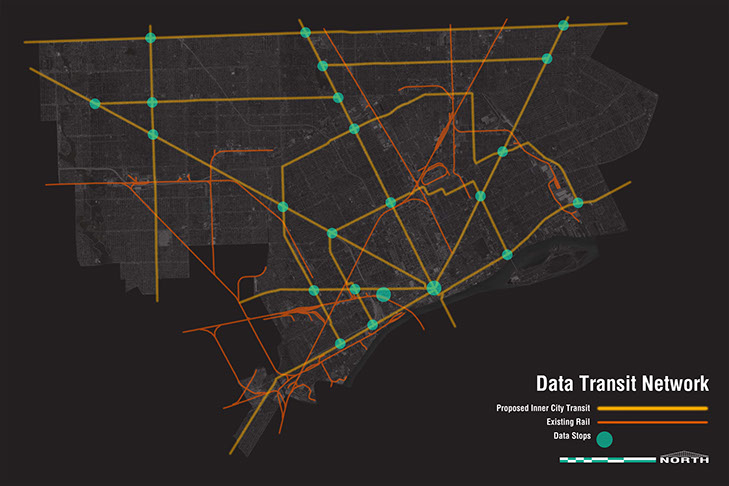
Map of the overall Data
Transit Detroit Network
Map of the 8 Mile
Crosstown Route
Map of the E 7 Mile/
W McNichols Crosstown Route
Map of the
Southfield Line
Map of the Fort/
Jefferson Line
Map of the
Outer Ring Line
AMap of the
Inner Ring Line
Map of the
Michigan Ave. Line
Map of the
Grand River Line
Map of the
Gratiot Line
Map of the
Woodward Line
Satellite view of the
Campus Martius Data Hub site
Figure ground study of the
Campus Martius Data Hub site
Circulation study of the
Campus Martius Data Hub site
Study of data users in the
Campus Martius area
Scale comparison between the Campus Martius
Data Hub site and 350 E. Cermak
<
>
Data Transit Detroit
Project Status – Concept
Scope – Research | Master Planning | Mapping | Site Selection
Data Transit Detroit was done as an initial study of the city of Detroit to identify and design a robust and much needed mass-transit network that could double as a network for big data. Through the utilization of Detroit’s unique urban grid, 10 major lines were developed with individual connection points doubling as major data facilities. Each line also had a key site identified as a potential mixed used development site that could double as a data facility. Secondary stations would also serve data functionality and were all selected because of their physical location in relation to the population it would serve as well as the ability to have a usable site already in that location. The culmination was the selection process of a site to be utilized for the Data Center Detroit project.
